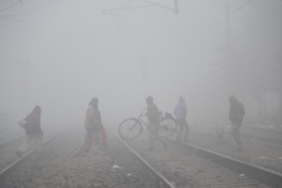
After June 12, there was a prolonged respite in the monsoon, with its progress slowing down until June 20. It has not yet moved across northwest India, where this month’s rainfall deficit has reached 57%.
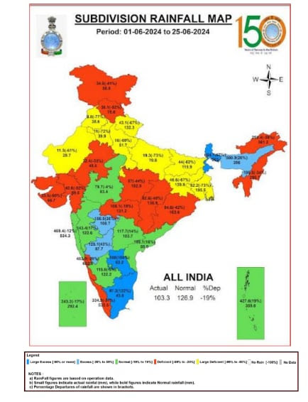
India’s rainfall deficit this June has fallen 19% below the long-term average due to the monsoon’s slow pace. Following an extended gap in the monsoon after June 12, 21 out of 36 subdivisions have seen monthly rainfall that is below average.
The India Meteorological Department (IMD), which had previously estimated that India would receive normal rainfall this month, had to update its original forecast on June 18 and downgrade it to “below normal,” meaning that the country will see rains that are less than 92% of the long-period average (LPA).
Dr. Mrutyunjay Mohapatra, the director general of meteorology, stated that the MeT constantly modifies the forecast as the weather changes. Rainfall’s geographic distribution can change. In June, we had predicted below-average rainfall in northwest India and significant rains over the southern peninsula and northeastern regions. However, we discovered as the monsoon advanced that the Bay of Bengal current was marginally weaker, which hampered its advancement over the eastern states. Thus, we made the earliest possible revision to the projection. This may occur if certain weather systems fail to form in order to bolster the monsoon, he stated on Tuesday.
As of June 25, India’s current rainfall deficit is 19% below the LPA. The largest disparity, around 57 percent, is seen in northwest India, which had prolonged heatwaves in June with temperatures reaching over 47 degrees Celsius.
Over eastern and northeastern India, it was recorded at -16%, and over central India, at -23%. Only on the southern peninsula have there been more rainfall than usual thus far; there, the current level is 9% over the LPA.
The initial prediction of above-normal rainfall over the southern peninsula came to pass, but it was not as accurate over northwest India and the surrounding central regions of India. “We had anticipated below-normal rainfall over northwest India, but the actual amount was significantly lower.” The monsoon from the eastern side moved more slowly than usual. Thus, portions of Chhattisgarh, Bihar, and Uttar Pradesh were not covered in a timely manner. The current was diminished since the easterlies (winds) did not establish themselves adequately, according to senior IMD scientist Dr. DS Pai.
The IMD had expected normal rainfall for India in June at 92 to 108 percent of the LPA in its original projection. In terms of geography, above-average rainfall were predicted for the southern peninsula, the central region that it borders, and a few isolated regions in the northwest and northeast of India. Additionally, it predicted below-average rainfall in numerous regions of central and eastern India as well as the northern and eastern regions of northwest and eastern India.