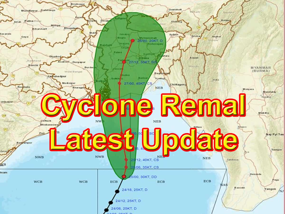
According to the India Meteorological Department (IMD), a low-pressure system over the Bay of Bengal intensified into severe cyclonic storm Remal, which is expected to make landfall between the beaches of West Bengal and Bangladesh at midnight on Sunday.
According to the weather department, extremely heavy rainfall has been predicted in the coastal districts of West Bengal and north Odisha on May 26 and 27. Parts of northeast India may also witness extremely heavy rainfall due to the impact of Remal on May 27 and 28.
In its latest bulletin on Sunday morning, the IMD said Remal was centred approximately 360 km south-southeast of Khepupara in Bangladesh and 350 km south-southeast of Sagar Island in West Bengal.
With a wind speed of 110-120 km per hour, gusting to 135 kmph, Remal is expected to cross the West Bengal and adjoining Bangladesh coasts between Sagar Island and Khepupara on Sunday midnight, the Met Department said. At the time of the landfall, a storm surge of up to 1.5 metres is expected to inundate low-lying areas of coastal West Bengal and Bangladesh.
In view of the cyclone, the coastal districts of North 24 Parganas and South 24 Parganas in West Bengal is under red alert on May 26 and 27 as extremely heavy rainfall is predicted in some areas.
An orange alert was issued for Kolkata, Howrah, Nadia, and Purba Medinipur districts, with the weather office warning of wind speeds touching between 80 to 90 kilometres per hour, gusting to 100 kilometres per hour. Heavy to very heavy rainfall was predicted at few places on May 26 and 27.
The Indian Coast Guard (ICG) said nine disaster relief teams were kept on standby at Haldia and Fraserganj in West Bengal, and Paradip and Gopalpur in Odisha. It said all pre-emptive measures were taken to ensure there was no loss of life or property at sea.
Meanwhile, the authorities of Kolkata’s Netaji Subhas Chandra Bose International Airport have decided to suspend flight operations for 21 hours from Sunday noon as the state braces for Cyclone Remal.
